Mapping Seedling Success with Remotely Piloted Aircrafts and Machine Learning

In 2024, IEG developed an innovative remote sensing workflow to identify newly planted seedlings across a reclamation area, classify them by species, and monitor their survival and growth over time. The workflow leverages high-resolution imagery collected by Remotely Piloted Aircraft (RPA) and advanced machine learning techniques. This approach scales seedling analysis from small sample plots to the entire site, delivering accurate, spatially explicit insights into seedling performance under varying site conditions. The result is faster, more informed decision-making that enhances the effectiveness and efficiency of reclamation efforts.
The method was applied to a two-hectare revegetation area planted with aspen, lodgepole pine, and white spruce. Using multispectral RPA imagery, seedlings were automatically detected, classified by species, and assessed for health using Object-Based Image Analysis and Random Forest models. Over 10,000 individual seedlings were geolocated and tagged with species and health attributes.
With precise seedling locations and spatial context, confounding factors such as slope position and microtopography were evaluated. Once these effects were accounted for, key treatment variables—like cover material and bulk density—emerged as strong drivers of seedling performance. For example, bulk density alone explained 71% of the variation in aspen growth within one soil type.
UAV Soil Amendment Mapping at Detour Lake Mine
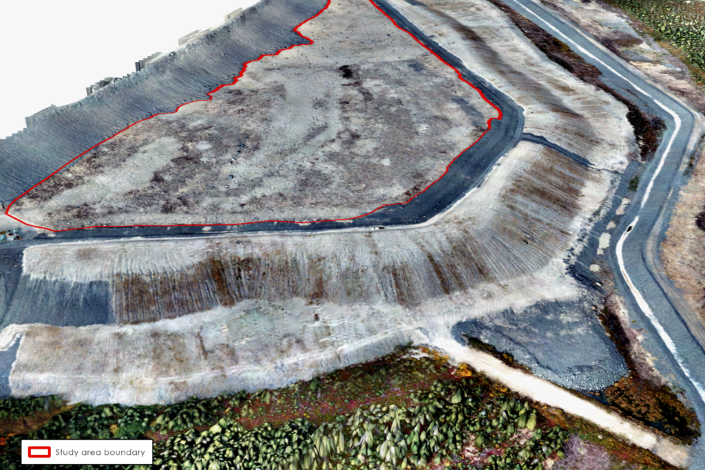
In partnership with BGC Engineering, IEG conducted a UAV survey of an organic matter reclamation cover on a constructed plateau at Detour Lake Mine. The objective of the project was to assess the distribution of a peat mineral mix (PMM) used as a cover material and create a spatially explicit map of PMM distribution to be used as a covariate in a revegetation trial.