Fort McKay Métis Nation Cumulative Effects Assessment and Toolkit
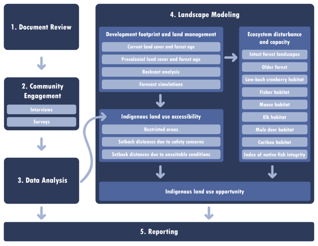
The capacity of environmental impact assessment (EIA) to understand cumulative effects to Indigenous territories in Canada is limited by the narrow scope of assessments and the marginalization of Indigenous knowledge. To address this gap in the EIA process, IEG worked with the Fort McKay Métis Nation (FMMN) of northeastern Alberta to bring together Indigenous knowledge and simulation modeling for a more comprehensive assessment of cumulative effects to Indigenous land use.
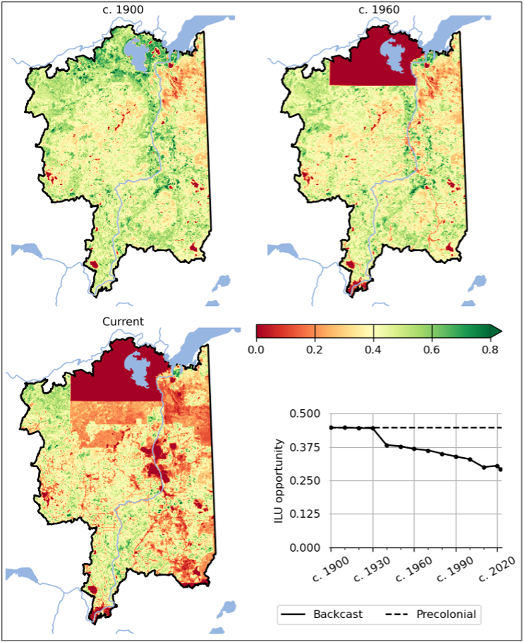
Interviews established that the ability of FMMN members to hunt, fish, trap, and harvest in their territory has rapidly diminished in recent decades. This finding was corroborated by an ALCES simulation of a 103,000 km2 region that reconstructed landscape changes occurring over the past 120 years in areas used by the Nation to harvest wildlife, fish, and plants. The simulation demonstrated that development footprint, negligible until the 1970s, has since expanded largely due to oil sands and forestry development. In response, opportunity for Indigenous land use has declined substantially relative to pre-colonial state. Forecast simulations determined that future development is expected to continue to degrade Indigenous land use.
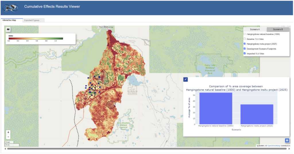
To support ongoing assessment of proposed projects by FMMN, a user-friendly assessment tool was developed that allows FMMN to prepare maps and charts demonstrating the impacts of proposed projects in combination with existing development footprint on the ability of members to harvest wildlife and plants from their territory.
The project was supported by funding form the Impact Assessment Agency of Canada and the Indigenous Centre for Cumulative Effects.
The project’s methodology brought together Indigenous knowledge and simulation modeling to deliver a comprehensive assessment of cumulative effects to Indigenous land use.
The project found that opportunities for moose harvest and other types of Indigenous land use has declined substantially from precolonial conditions over the past century.
The cumulative effects assessment tool allows FMMN to visualize impacts of proposed projects in combination with existing development on the ability of members to harvest wildlife and plants from their territory.